

Every property tells two stories. One is visible: the slope of the land, the view, the vegetation, the road access, the nearby homes, the coastline, or the open space around it. The other story is hidden underground. That second story can be just as important as the first, especially when land is being evaluated for development, construction, long-term planning, or investment.

Quick Snapshot
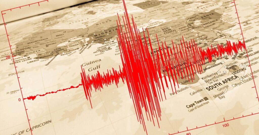
• What if the biggest factor shaping a property’s future is something you can’t even see? High-resolution seismic imaging helps reveal the underground conditions that can influence development, planning, cost, and long-term stability.
• From hidden rock layers to soil changes and drainage concerns, underground mapping gives property owners, developers, and planners the insight they need before major decisions are made.
• Planning land in Maui or any complex property market? This guide shows how subsurface mapping can turn uncertainty into confidence and help create smarter, safer, more thoughtful development from the ground up.
For developers, buyers, and property owners evaluating Maui land, high-resolution seismic imaging can provide a clearer understanding of underground conditions before major planning or construction decisions are made. Before a foundation is poured or a design is finalized, project teams need to understand what is happening below the surface. Soil layers, rock formations, buried voids, groundwater pathways, old fill, fault zones, and unstable ground can all influence how a property should be developed.
Subsurface imaging helps reveal these underground conditions with far more detail than surface observations alone. With the support of Seismic Data Processing & Imaging Services and thorough analysis, raw subsurface information can be turned into reliable insights that aid site design, construction safety, and development planning. For property development, this kind of underground mapping is not only about science. It is about making better decisions earlier. It helps reduce uncertainty, protect budgets, support safer construction, and guide thoughtful land planning.
In places like Maui, where land is closely tied to lifestyle, community, natural beauty, and island living, understanding the ground beneath a property can be essential to responsible development.
What High-Resolution Seismic Imaging Actually Does
High-resolution seismic imaging is a geophysical method used to create a clearer picture of what lies beneath the ground. In simple terms, it measures how energy waves move through soil, rock, and other underground materials. By examining how various materials behave, specialists can gain insight into the characteristics and condition of the subsurface.
This process can reveal changes in soil density, rock depth, underground layers, buried channels, weak zones, and other features that may affect construction. Unlike basic site observations, seismic imaging gives project teams a more detailed understanding of the land before major design or building decisions are made.
For property development and planning, this information can be valuable because the surface of a parcel does not always show the full picture. A site may appear stable, buildable, or straightforward at first glance, but underground conditions can tell a different story. There may be deep soil variation, hidden rock, drainage issues, or areas requiring special foundation design.
High-resolution seismic imaging does not replace engineering judgment, soil testing, or professional inspections. Instead, it brings added perspective to the analysis. It helps create a more comprehensive site assessment, providing decision-makers with better information before they commit to a construction plan.
Why Underground Mapping Matters Before Development Begins
The early stages of property development often involve many visible questions. Where should the structure be placed? How should the driveway connect? What views should be preserved? How will the building sit within the surrounding landscape?
But some of the most expensive and disruptive questions are underground. Is the soil strong enough to support the structure? Will excavation be simple or difficult? Are there hidden rock layers? Could drainage become a problem? Is the site likely to require deeper foundations, retaining systems, or special preparation?
Underground mapping helps answer these questions earlier in the process. When developers understand subsurface conditions before construction begins, they can avoid many costly surprises. A clearer view of the underground environment can lead to smarter design, more accurate budgeting, and better coordination between engineers, architects, builders, and property owners.
Projects with greater scope or investment often gain the most from this approach. A residential estate, coastal property, hillside home, subdivision, or custom build may require careful planning because even small underground issues can affect the final outcome. Seismic site analysis gives the project team a stronger starting point.
Good development is not only about what can be built. It is also about what should be built, where it should be placed, and how the land can support it over time.
How Seismic Imaging Supports Smarter Site Planning
Site planning becomes more effective when decisions are based on both surface conditions and subsurface information. High-resolution seismic imaging can help project teams better understand how the land is structured beneath the visible grade.
For example, if imaging shows that bedrock is shallow in one area and much deeper in another, that information may influence where a building is placed. If one part of the site contains weaker or less consistent material, engineers may recommend a different foundation approach. If underground layering suggests drainage movement, planners may adjust grading, water management, or infrastructure placement.
This kind of information can guide several important development decisions, including:
– Building placement and orientation
– Foundation design considerations
– Excavation planning
– Retaining wall locations
– Driveway and access routes
– Drainage and stormwater planning
– Utility corridors
– Long-term maintenance expectations
The value is not only technical. Better information makes the entire planning process more intentional. Instead of reacting to underground surprises after work begins, developers can make informed choices from the beginning.
For Maui property development, this can be particularly meaningful. Island properties often involve unique combinations of terrain, coastal influence, volcanic geology, slopes, weather exposure, and environmental sensitivity. A thoughtful approach to underground mapping can help support planning that respects the land while still allowing a property’s potential to be carefully realized.
Reducing Risk Without Slowing Creativity
One of the misconceptions about technical site studies is that they limit creativity. In reality, good information often gives designers and developers more freedom, not less. When the underground conditions are understood, the project team can design with greater confidence.
Geophysical imaging helps reduce risk by identifying potential concerns before they become expensive problems. It can help reveal whether certain areas of a property may need additional study, stronger support, or a different construction strategy. This allows a project’s creative vision to move forward with fewer unknowns.
For architects and designers, subsurface information can support better decisions about structure placement, elevation changes, outdoor spaces, and access. For engineers, it provides useful data for assessing site stability and foundation requirements. For property owners, it creates greater confidence that the project is being planned with care.
The goal is not to make development feel rigid or overly technical. The goal is to make it more informed. A beautiful home, estate, or community space still begins with vision. Seismic imaging simply helps ensure that the vision is grounded in a real understanding of the land.
The Role of Seismic Imaging in Budget and Timeline Planning
Unexpected underground conditions can quickly affect a development budget. Difficult excavation, unstable soil, hidden rock, drainage issues, or unexpected foundation requirements may lead to redesigns, delays, or additional construction costs.
Underground site mapping can help reduce these uncertainties. While no study can guarantee that every condition will be known in advance, underground mapping gives developers a stronger basis for estimating what the project may require.
This can be helpful in several practical ways. A builder may better anticipate excavation needs. An engineer may recommend appropriate foundation strategies earlier. A property owner may understand why one part of the land is more suitable for construction than another. A developer may make more realistic decisions about project scope before major funds are committed.
In property development, early clarity often saves time later. When a project team has better subsurface information, there is less reliance on guesswork. That can lead to smoother coordination, fewer avoidable changes, and a more realistic path from planning to construction.
Why Maui Land Planning Requires a Thoughtful Approach
Maui is not just a location. It is a place where land, lifestyle, culture, environment, and community are closely connected. Development decisions here often carry more meaning than simply choosing where to build. They involve respect for the natural setting, awareness of local conditions, and sensitivity to how a property fits into the broader island landscape.
For Maui land planning, subsurface evaluation can support a more careful evaluation of a property’s strengths and limitations. Coastal areas, hillside parcels, rural land, and residential lots may each present different underground conditions. Understanding those conditions can help guide development in a way that is practical, stable, and better aligned with the site’s character.
This is where the connection between underground mapping and Maui lifestyle becomes important. A well-planned property should not only look good on the surface. It should function well over time. It should consider drainage, access, stability, landscape design, construction impact, and long-term use.
Responsible property development in Maui benefits from this type of deeper understanding. The more a project team knows about the land, the better they can plan in a way that supports both the property and its surroundings. This is especially valuable for buyers evaluating Maui’s residential market, where location, terrain, lifestyle, and long-term property goals often work together.
From Raw Land to Buildable Vision
Every development project begins with possibility. A vacant parcel may suggest a future home. A hillside lot may offer views and privacy. A coastal property may inspire open-air living and a stronger connection to the landscape. But possibility must eventually meet practicality.
High-resolution seismic imaging helps bridge that gap. It gives developers and property owners a clearer understanding of whether the vision for a site matches the physical conditions beneath it. If the land is suitable, imaging can help confirm the planning direction. If concerns arise, they can be addressed before they become larger problems.
This is especially useful when comparing multiple areas within the same property. One section may be better suited for the main structure, while another may be better for landscaping, access, or open space. Underground mapping can help identify these differences and support more strategic land use.
In this way, seismic imaging does not simply answer the question, “Can this land be developed?” It helps answer a better question: “How can this land be developed wisely?”
Practical Takeaways for Property Owners and Developers
For anyone considering property development, underground mapping should be seen as part of a thoughtful planning process. It is not necessary for every simple project, but it can be extremely valuable when the site is complex, the investment is significant, or the land conditions are uncertain.
Property owners and developers should consider high-resolution seismic imaging when:
– The property has slopes, uneven terrain, or unknown soil conditions
– The project involves major excavation or foundation work
– The site is coastal, hillside, rural, or geologically complex
– There are concerns about drainage, stability, or buried features
– The development budget depends on reducing unexpected construction risks
– Long-term property performance is a priority
The most important benefit is confidence. Better underground information helps everyone involved make decisions with a clearer understanding of the land. It supports better planning, stronger communication, and more realistic expectations.
For owners thinking about long-term value, this kind of planning also connects with broader property improvement decisions, including renovation strategy, site preparation, and responsible land use. Thoughtful planning can help a property perform better not only during construction, but throughout its future use and potential market value.
Frequently Asked Questions
✓ What is high-resolution seismic imaging?
High-resolution seismic imaging examines underground features by tracking the movement of seismic waves as they travel through soil, rock, and other subsurface materials. It helps identify underground layers, weak zones, rock depth, and other features that may affect property development and planning.✓ How does seismic imaging help property developers?
Seismic imaging helps developers understand what lies beneath a site before construction begins. This can support better decisions about foundation design, building placement, excavation, drainage, utilities, and overall land planning.✓ Can underground mapping reduce construction costs?
Underground mapping can help reduce unexpected costs by identifying possible site challenges early. It may help developers avoid surprise excavation issues, foundation changes, drainage problems, or delays that could increase the overall budget.✓ Is high-resolution seismic imaging worth the cost before development?
High-resolution seismic imaging can be worth considering when a project involves significant investment, uncertain land conditions, slopes, coastal exposure, or major excavation. Identifying subsurface concerns early may help reduce unexpected costs later.✓ How accurate is high-resolution seismic imaging?
The accuracy of seismic imaging depends on site conditions, equipment, survey design, and professional interpretation. It can provide valuable insight into underground patterns, but results should be reviewed alongside soil testing, engineering analysis, and other site studies.✓ Can seismic imaging identify groundwater or drainage concerns?
Seismic imaging can help identify underground patterns that may suggest moisture movement, buried channels, weak zones, or changes in soil and rock conditions. It does not replace drainage engineering, but it can show where further evaluation may be needed.✓ What types of Maui properties benefit most from underground mapping?
Maui properties with slopes, coastal exposure, volcanic geology, rural acreage, uneven terrain, drainage concerns, or high-value development plans may benefit most from underground mapping. It can also help owners compare possible building areas within the same parcel.✓ How much can underground conditions affect property development costs?
Underground conditions can significantly affect development costs because soil strength, rock depth, drainage, slope stability, and excavation difficulty may influence foundation design, site preparation, equipment needs, labor, and construction timelines.✓ When should a property owner consider seismic imaging before building?
A property owner should consider seismic imaging when a site has slopes, coastal exposure, uncertain soil conditions, major excavation needs, or a high-value construction plan. It may also be useful when comparing different building areas within the same property.✓ Is seismic imaging useful for Maui property development?
Yes. Seismic imaging can be useful for Maui property development, especially when a site has slopes, coastal exposure, complex terrain, or uncertain soil and rock conditions. It supports more informed planning that respects the unique character of Maui land.✓ Does seismic imaging replace soil testing or engineering studies?
No. Seismic imaging does not replace soil testing, engineering studies, or professional inspections. It works alongside those methods by providing additional underground information that can improve the overall site assessment.✓ Why is subsurface mapping important before building?
Subsurface mapping is important because underground conditions can affect safety, cost, design, construction timelines, drainage, and long-term property performance. Understanding the land beneath the surface helps developers and property owners plan with fewer unknowns.
Building With a Better Understanding of the Land
High-resolution seismic imaging gives property development a stronger foundation before construction even begins. By revealing underground conditions that are not visible on the surface, it helps developers, engineers, architects, and property owners make smarter, more responsible decisions.
For Maui and other places where land carries both practical and personal value, this deeper understanding matters. It supports better planning, protects long-term investment, and encourages development that works with the land rather than against it.
The most successful projects are not built on appearance alone. They are shaped by careful planning, informed understanding, and a deep regard for the location. Mapping the underground is one way to bring all three into the planning process, helping turn a promising piece of land into a well-considered, lasting property.